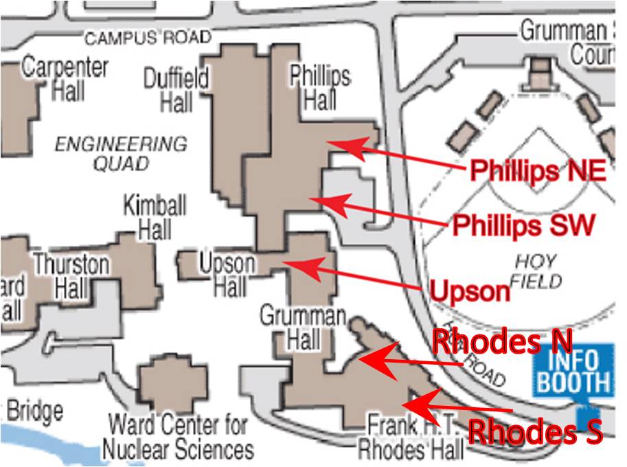
Phillips Hall North-East (PHNE)
|
This antenna is located above the east wing of Phillips Hall. Its coordinates are:
Latitude: 42.444586
Longitude: -76.481988
Altitude: 229.668 m
|
|
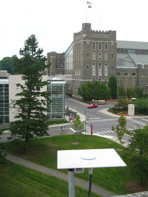
View of the Phillips Hall North-East Antenna looking north towards Barton Hall. Download a movie of the 360 degree view around this antenna (mp4) or (wmv). The view starts from the east and rotates around to the south, then west, then north, then back to the east again.
|
Phillips Hall South-West (PHSW)
Not currently used for lab
|
This antenna is located directly above Phillips Hall 239 (GPS Laboratory). Its coordinates are:
Latitude: 42.444306
Longitude: -76.482070
Altitude: 223.243 m
|
|
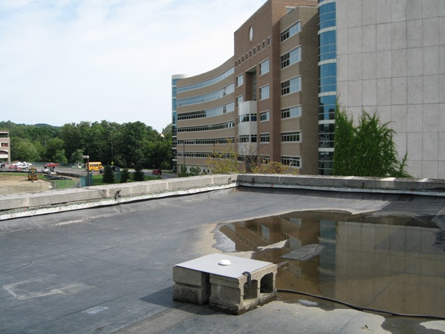
View of Phillips Hall South-West Antenna looking south towards Rhodes Hall. Download a movie of the 360 degree view around this antenna (mp4) or (wmv). The view starts from the east and rotates around to the south, then west, then north, then back to the east again.
|
Upson
Not currently used for lab
|
This antenna is located directly above the Upson Hall elevator shaft. Its coordinates are:
Latitude: 42.444007
Longitude: -76.482229
Altitude: 236.548 m
|
|
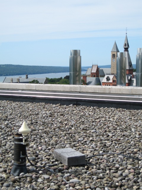
View of Upson Antenna looking north towards Cayuga Lake. Download a movie of the 360 degree view around this antenna (mp4) or (wmv). The view starts from the east and rotates around to the south, then west, then north, then back to the east again.
|
Rhodes Hall North (RHN)
|
This antenna is located above the center section of Rhodes Hall. Its coordinates are:
Latitude: 42.443545
Longitude: -76.481790
Altitude: 253.94 m
|
|
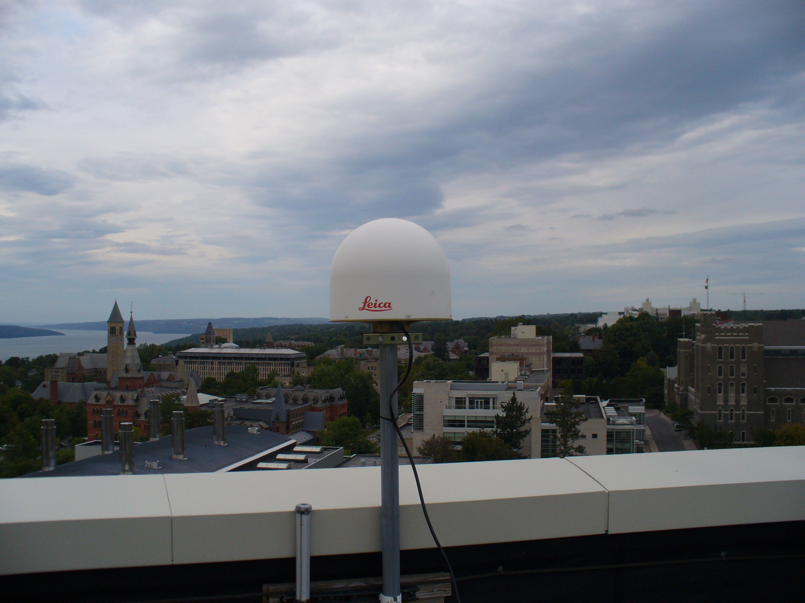
View of Rhodes Hall North Antenna, looking north towards the Arts Quad and Cayuga Lake. Download a
movie of the 360 degree view around this antenna (mov). The view starts
from the east and rotates around to the south, then west, then north, then back to the east again.
|
Rhodes Hall South (RHS)
|
This antenna is located above the center section of Rhodes Hall. Its coordinates are:
Latitude: 42.443327
Longitude: -76.481433
Altitude: 250.335 m
|

|
View of Rhodes Hall South Antenna, looking east towards the parking garage and the stadium. Download a
movie of the 360 degree view around this antenna (mov). The view starts
from the east and rotates around to the south, then west, then north, then back to the east again.
|
|
Campus map of engineering quad indicating GPS antenna positions
|

|
Aerial image of engineering quad indicating approximate GPS antenna positions
A link to the Google map is here.
|